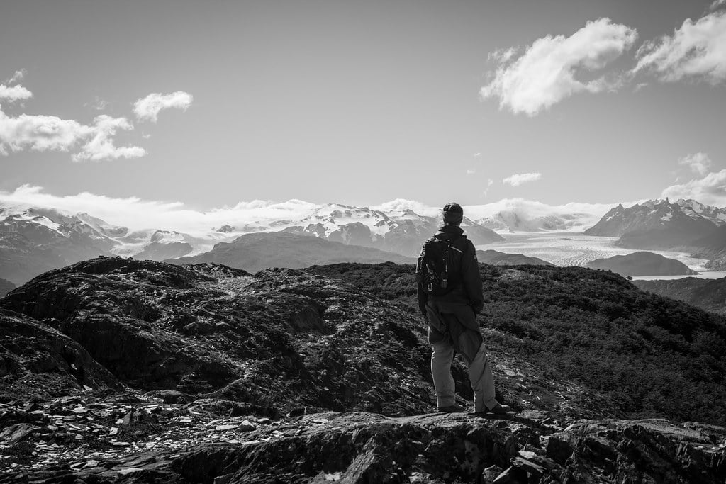
Psssst…we have a secret for you, dear hiker. We know the most impressive off-the-beaten-path hikes in Torres del Paine National Park, and will tell you everything you want to know about them.
But, please, we want to keep it as wild and quiet as it is, so don’t tell anyone…
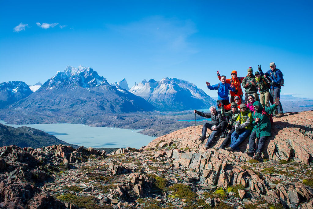
OK, seriously, we hope these trails are going to stay as beautiful as they are, but think it is worth sharing the tips, so that more people can discover how diverse, surprising, almost infinite the hiking possibilities in Patagonia’s most stunning National Park. Here, you will not find classic (and busy) hikes such as French Valley, the towers’ base lookout or Grey trail; nor the trails you will hike on the W Trek or the Paine Circuit ("O Trek"). Rather, you will get an insight into less famous short and long hikes you can do (or mix!) in one day or/and (even better!) enjoy with experienced guides on a EcoCamp Patagonia Wildlife Safari. So lace up your hiking shoes and choose the hike that fits you best!
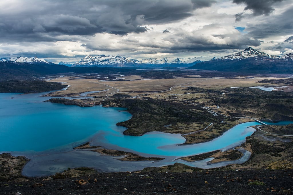
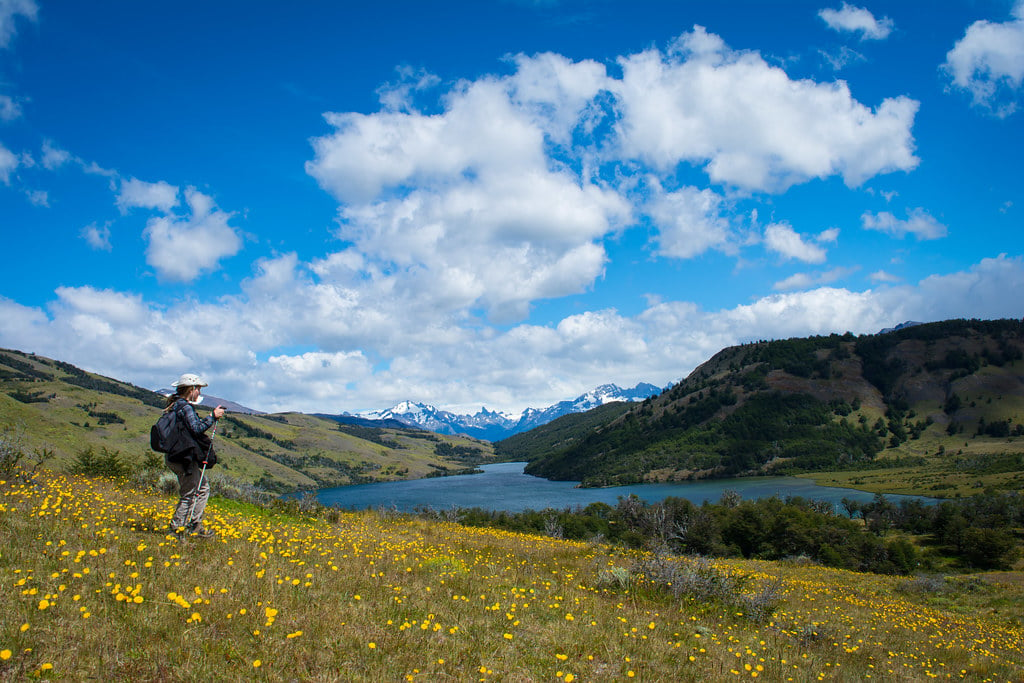
1. Sierra Masle (Laguna Azul)
Difficulty : Easy
Distance : 4km/2mi
Elevation : 400m/1312ft
Duration : 1h30
Let’s be honest: this is not the most epic trail nor the most demanding. However this may be one of the most beautiful lookouts in the area. A time travel too, as you follow the footsteps of Florence Dixie, a British traveler and writer who reached Torres del Paine in 1878 – she is still considered as the first tourist to have visited the area. In her book Across Patagonia (1880), she describes the landscapes as a postcard; she reached Laguna Azul with local baqueanos (local “cowboys”) and got marveled by the beauty of the big and old coigues, ñirres and lengas – austral trees – that make the place a picture-perfect setting to forget about time and hike slowly along the trees.
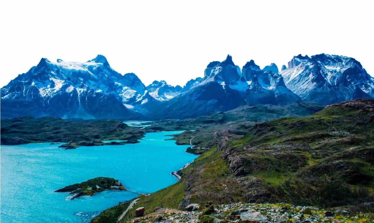
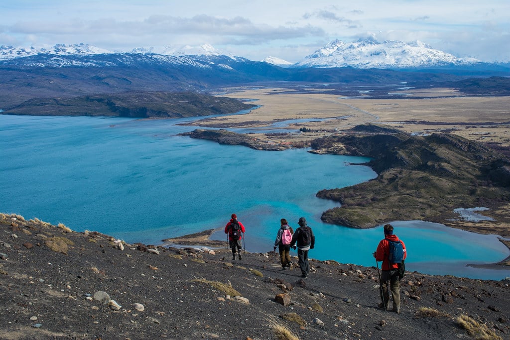
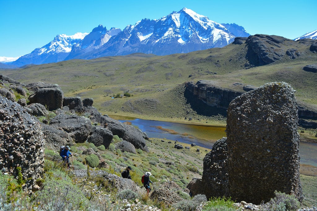
Laguna Azul is a dazzling blue lake located in the Eastern part of the National Park, about 45 minutes driving from the park’s entrance “Laguna Amarga”. Park your car at the shore of the lake and follow the trail to Sierra Masle, a small mountain range on the Eastern side of lake. Walk about an hour to reach an erratic rock – a massive rock that have been brought here in the middle of nowhere by the glaciers millions of years ago. From there, you will certainly not believe the piercing blueness of Laguna Azul and the majestuosiy of the towers; a unique perspective that will allow you to observe the granite peaks from a different angle. An easy hike for such a good ending!

2. Lazo-Weber
Difficulty : intermediate
Distance : 12km/7,50mi
Elevation : 800m/1970ft
Duration : 5h
The bad news about off-the-beaten-path is that some of them require some extra logistics to make the hike possible. In the case of Lazo-Weber, you’ll need either 2 vehicles (not recommended), either a private driver to pick you up at the end of the hike. Or do it round trip – the least pleasant option. If you’re lucky enough to do it with a guide, then get ready to enjoy one of the most fabulous hikes in the national park!
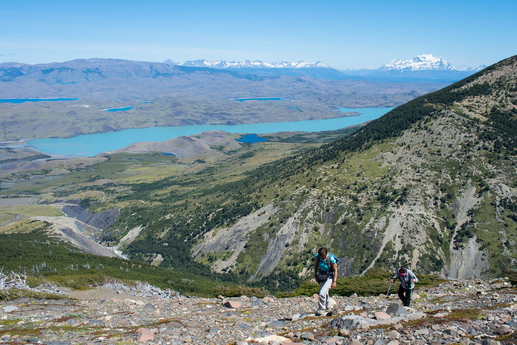
The hike goes from East to West and starts at the shore of Laguna Verde, in Estancia Lazo, a local farm used for tourism and cattle. Don’t be surprised to cross some hippie cows on the way! All along the hike you’ll see the Paine Mountain range on your right side, so you’ll observe the mountains from heaps of different angles. Maybe the best way to see most of the classic peaks of the National Park: Almirante Nito (2670m/8759ft), Los Cuernos (2600m/8530ft), Cerro Fortaleza (2900m/9514ft) and Paine Grande(10006ft).
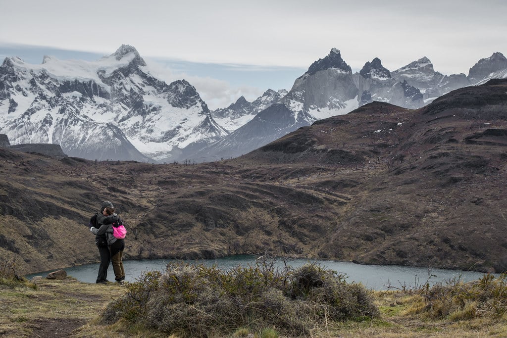
Hiking through the silent forest will teach you a lot about the local fauna & flora: the place is packed with mushrooms, flowers and orchids; allowing you to understand that Patagonia is not actually as arid as you may think. After you pass Laguna Honda (a small, kinda unexpected lake), the trail goes uphill for a while, bringing you to the trail’s highest point: a 360º incredible lookout of the Western Area of the National Park – and when I say incredible, I weigh my words. In short, you’ll see the definition of “spectacular.”
The hike is not over: a 1-hour fun descent towards the Paine River will see you reunited with your van, car, or whatever will bring you back home. As you reach the Wever bridge, you’ll be happy about you did – and understand why this hike is called “Lazo-Weber!”
3. Pingo Trail
Difficulty : Easy
Distance : 8km/5mi (much more if you go to Zapata)
Elevation : 150m/490ft
Duration : 3h
You may find it fun to park your car in one of Torres del Paine’s most popular areas (Grey Glacier) without actually following the herds of people heading to the glacier (an incredible attraction, though). Bad news for this hike: you’ll need a special permit to go on the trail – delivered by CONAF, the national forestry organization. Good news: it increases the feeling of isolation and makes the experience way wilder.
If you’re the luckiest hiker on Earth, sure you’ll have the permit. But we believe you won’t, so be nice: follow the guide and enjoy the sweet sound of the Pingo River as you hike along its shore. Pingo Trail has a lot to teach you. First, it offers you one of the best opportunities – probably in the whole Chilean Patagonia – to spot the Huemul (South Andean Deer), an endangered deer species that is as scarce as elegant. Second, it is a trip to the forgotten past of Torres del Paine, and really, you’ll probably be moved to see one of the oldest “refuges” in the National Park; an ancient house that reminds me (a bit) of the haunted houses of the “Blair Witch Generation” (you know, the houses you only see in horror movies of the 90s). This should be classified UNESCO World Heritage Site – and I’m barely kidding.

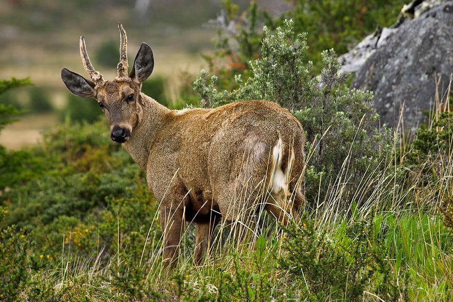 A huemul (only if you're very lucky)!
Last but not least, you’ll see the Paine Grande mountain and Los Cuernos from a different perspective while enjoying the view of unspoiled waterfalls. My advice is to stop at “Chorillo de los Salmones” a small but beautiful waterfall hidden in the heart of the forest (1h30 from the beginning of the trail). Time will stop, and you’ll connect with nature and want to stay there forever. Now, if you want this hike to become the experience of a lifetime, you can still keep hiking and reach Pingo and Zapata glaciers – a marvelous landscape of the Southern Patagonian Ice Field which will require you to camp at “Refugio Zapata” (2 days are necessary).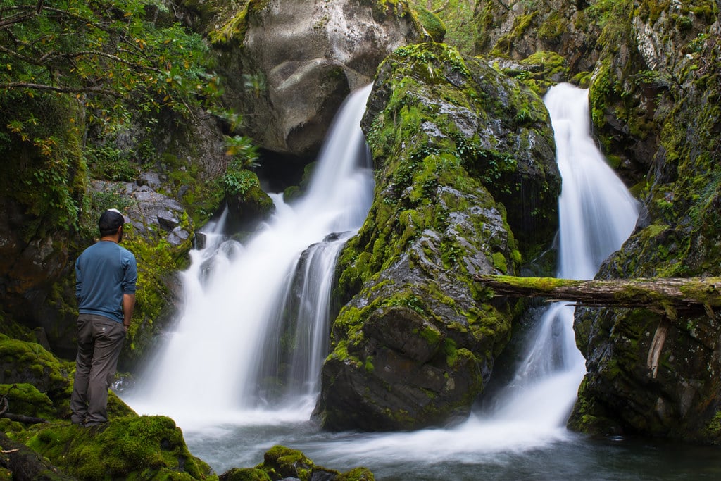 "Cascada Chorrillos de los Salmons", a waterfall that has something pretty special.
What is great: The best chance to spot the Huemul – an endangered species of Deer that can be found in few places around Chile.
4. Mt. Ferrier
Difficulty : demanding
Distance : 6km/4mi
Elevation : 700m/2300ft
Duration : 3h
For this one, same as Pingo Trail: drive to Grey and, instead of heading to the beach, raise your eyes and look at the huge peak on the East. That is Cerro Ferrier, a 1599m/5246ft wind-swept rock monster. If you are a bad-ass hiker, you may request a climbing authorization to CONAF and conquest its summit (but only if you’re a bad-ass hiker, right?). If you’re a passionate hiker like me, then hiking to its amazing lookout should be well-enough.
Stretch your muscles before the hike, because that’s intense! Good news, you’ll go through a fairy-tailesque forest; an insight into the fascinating diversity of austral trees. You’ll meet the classic Patagonian trees: lenga, coihue, ñire. Try to distinguish them – not as easy as you may think. If you’re lucky enough, you’ll meet the huemul, the famous South Andean Deer that lives in theses mountains. But, lucky or not, you’ll certainly sweat as you hike uphill. The landscapes are more and more impressive as you go up, so that it will make you want to grow higher!
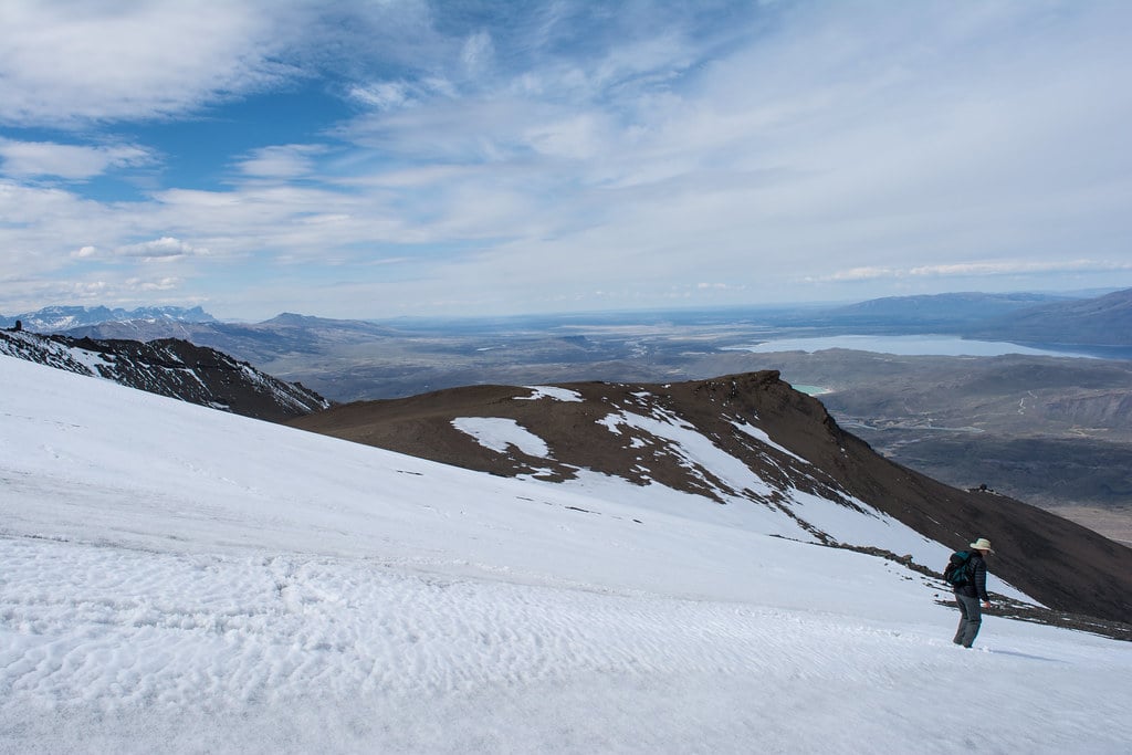
After an hour and a half, you will reach the unrivaled Ferrier lookout, a window to the Eastern part of Torres del Paine National Park – like a parallel universe as the view is simply unreal. On a clear day, the sky literally embraces the lakes and makes the blueness shine everywhere. From here, you can admire the Southern Patagonian Ice Fields in the distance, and a great part of the Paine Massif. But on a very windy day, be reasonable: Cerro Ferrer is one of the windiest places of the area. Your adventure can turn into a hurricane, and I am not sure you’ll actually enjoy it.
5. El Condor Lookout
Difficulty : moderate
Distance : 4km/2,50mi
Elevation : 500m/1640ft
Duration : 1h30
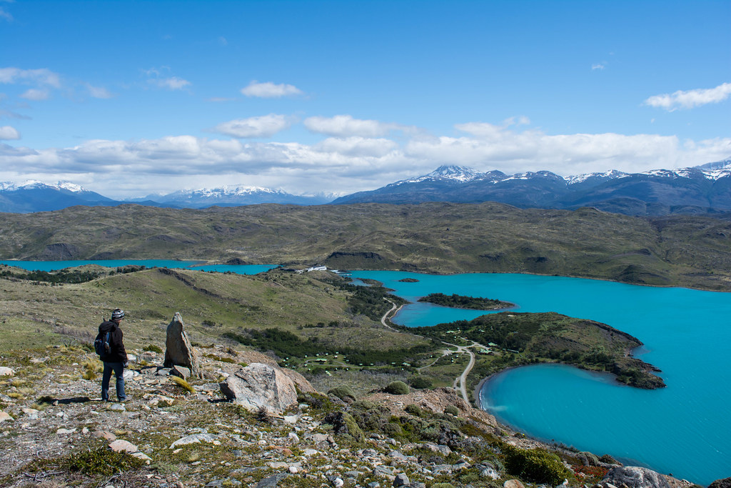
If you have time to lose as you pass along Pehoe Lake, stop by the Pehoe Lookout or Pehoe Campsite (either location is OK to start) and head to the condor lookout. You will feel like a condor indeed as you go uphill through the arid pampa, with the immensity of the lakes on your back. The wind gusts may help you hiking uphill for about an hour/an hour and a half to reach the so-called Condor Lookout, a kind of huge rock at the top of the hill.
El Condor trail, that’s an easy way to discover the flora of the Patagonian Steppe, with names as exotic as Mata Barossa, Mata Guanaco and the famous Calafate and its purple berries, which according to the legend will make you come back to Patagonia if you eat them. And sure you will want to come back when you catch a glimpse of the landscape; from there you will overlook the Paine Massif, with French Valley in the distance and the piercing Paine River that looks like blue ink from above. Enough to convince you did not lose your time hiking this trail; instead you spent a memorable time in the steppe.
6. Fauna Trail ("Portería-Portería")
Difficulty : easy
Distance : 8km/34mi
Elevation : 200m/650ft
Duration : 3h30
We decided to call it fauna trail for the constant flow of animals, yet you can name the trail as you wish. The formal hikers call it “Porteria-Porteria”, a short yet rewarding hike that starts from a National Park entrance (Porteria Lago Sarmiento) and ends in another (Porteria Laguna Amarga). At first sight, the area seems lifeless but if you are a patient observer, you will observe heaps of animals. Among them, herds of guanacos literally inhabit the trail and may even hike with you if they are in good mood.
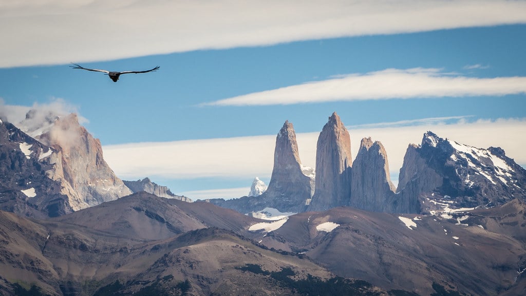
But, most exciting, the chances to spot the puma are relatively high, especially at dusk and dawn. Do not forget that in Torres del Paine most iconic animals live on the steppe, and the “flat lands” (there is nothing really flat in here) are a wild territory at the feet of the mountain range. We already saw 4 pumas together and up to 50 condors flying in a herd while hiking this one.
Just saying: a nice surprise awaits you in the middle of the hike. We will just mention two words here, just to make you curious: “Cave” and “Paintings”. Literally a 7000 years-old time travel that will make you think about the indigenous tribes that once inhabited the grandness of these landscapes.

What is great: The perfect cocktail of fauna and history and the herds of guanacos that stare at you as you hike a few meters only from them.
7. Cerro Paine
FAQ: You've got questions, we've got answers! Check our blog or the post below for all the Patagonia info!
Difficulty : demanding
Distance : 16km/9mi
Elevation : 1600m/5250ft
Duration : 8h
Underestimated, unspoiled, astounding, marvelous, spectacular…I am running out of words to talk about the beauty of Torres del Paine. If you ever hiked the W Trek or Paine Circuit and undertake the ascent to Cerro Paine (quite a steep hike indeed), you will barely understand why everyone hikes to the towers’ base lookout when almost no one knows the trail to Cerro Paine.
Unlike the other hikes on this page, Cerro Paine is a hike, a real, long and demanding one. Well, nothing too technical neither, and the hike would even feel quite easy for a hiking aficionado. But you will have to brave the rock and the wind if you want to touch Cerro Paine’s incredible summit.
Leave Las Torres area early morning and cross Estancia Cerro Paine’s fence (a guide is advised) to start the ascent through a quiet lenga forest. You may see lots of nice flowers, mushrooms and orchids before the trail gets steeper and the vegetation dramatically disminishes to become a desolated rocky area. All the way up, you will hike along the Almirante Nieto mountain (2670m/8760ft) and its impressive glacier and see the iconic granite towers. All this landscape for yourself!
After three hours you should reach the first lookout. Catch a glimpse to the Ascencio Valley; down there, you may see heaps of hikers heading to the towers’ base lookout – they will look as tiny as ants, as you will be 1200m/3939ft meters above sea level already! (the towers’ hike is “only” 900m/3000ft high).
What’s coming next? Up to you, my friend! But I would heavily suggest you to keep hiking for about an hour to reach the summit (1500m/4920ft) to enjoy one of the best lookouts ever. Everything, everywhere: pure magic. You’ll never forget that view on the lakes’ network of the national park, the Southern Patagonia Ice Fields peaks, the giants icy mountains in the horizon and the towers’ lagoon. Now, time to hike back (take care of your knees, please)!
Difficulty : easy
Distance : ..
Elevation : ..
Duration : ..
Somewhere in the Eastern part of Torres del Paine National Park inhabit some of the last Wild Horses in the world. And when I say wild, believe me, I'm weighing my words. These majestic animals live in a remote area and are therefore not used to see humans. They live peacefully in herds behind the Sierra Masle, a small mountain range close to Laguna Azul. I am pretty sure you will love the area for its beautiful lake (Laguna Smoke and Laguna Escondida) and its quietness. No chance to meet other tourists here: the area is restricted and you can only visit this wild territory with the Wild Horses trackers and researchers of Patagonia Bagual - a wonderful project I highly recommend.
Here, no rush. There is no destination: your mission is to enjoy while learning about the Wild Horses and their home. As far as I am concerned, I could stay hours watching to the horses and listening to the fascinating information of the guides. They know what they do, they love these animals, and they will make you love them too.
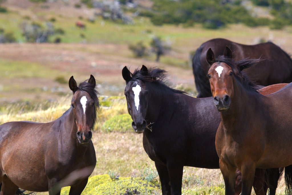
What is great: Connect with the horses and feel like to be a modern-day Lady Dixie in the heart of the wilderness!
Fancy doing all these incredible hikes? Go on a Wildlife Safari and experience the unforgettable. Also reach out to reservations@cascada.travel for more exclusive Patagonia info . We've got the best tips and tricks to help you plan the perfect trip!