


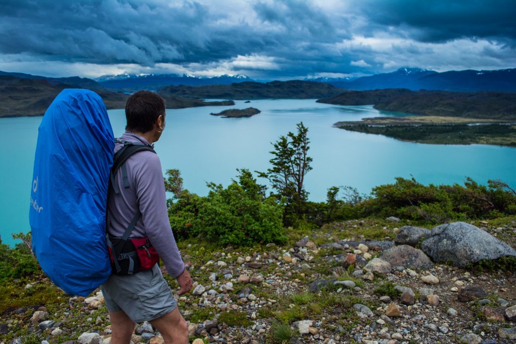
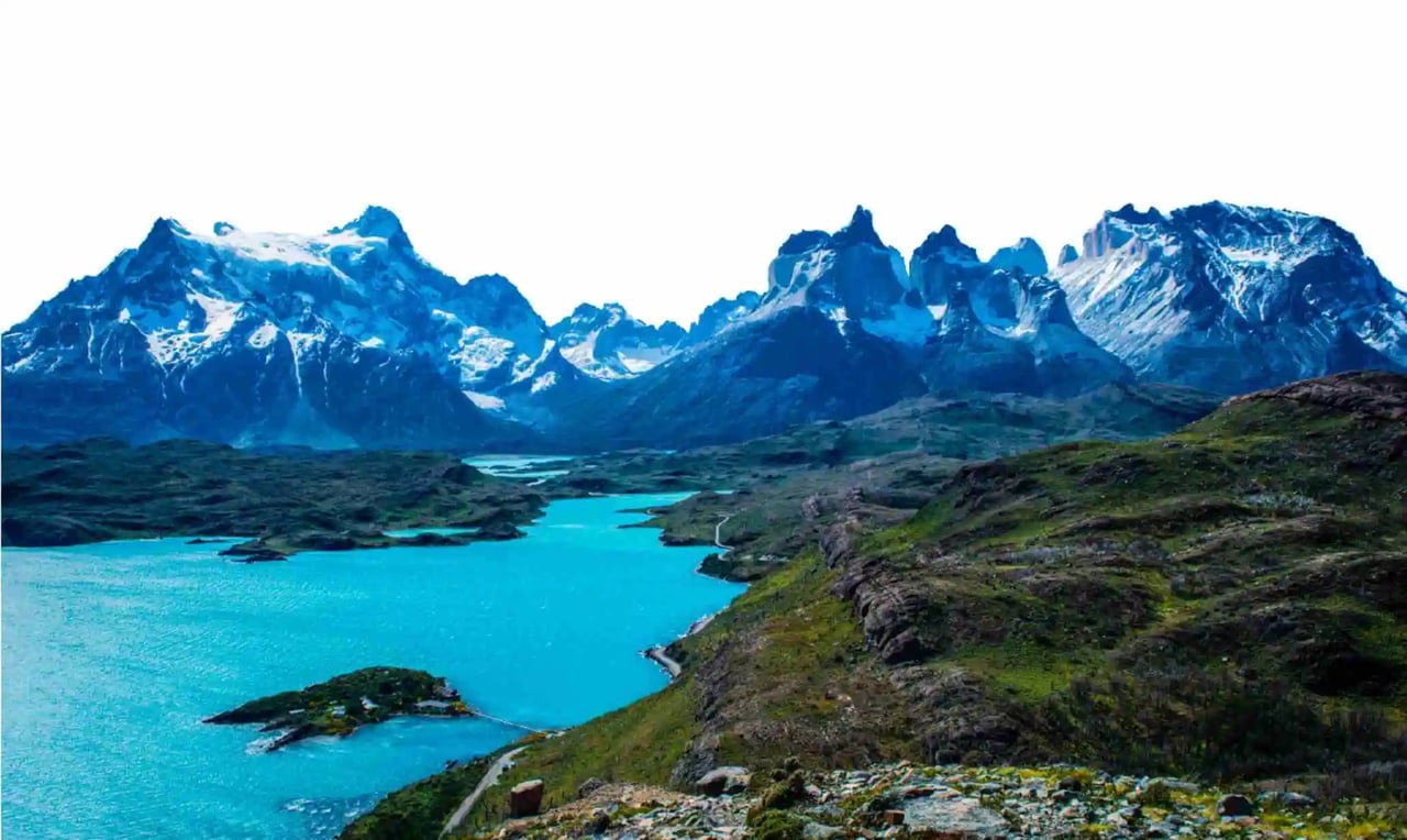
Take one quick look at Torres del Paine National Park and you’ll realize just how unique and beautiful its geography is. From vast valleys to icy glaciers to the magnificent Paine Towers that gave the park its name, Torres del Paine truly has it all. You can explore and enjoy these stunning Patagonian landscapes on a multiday hike or on a day trip.
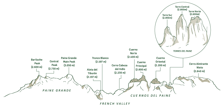
The most famous image of the Torres del Paine National Park is the breathtaking Paine Massif and its three jagged granite Towers. This mountain group, also known as the Cordillera del Paine, dominates much of the landscape in the park. The Paine massif is part of the Andes Mountains. However, it is an independent and different mountain formation.
"Paine" means blue in the language of the Tehuelche people language, one of the indigenous groups in Patagonia. It would refer to the bluish color of the granite when viewed from a distance.
Scientists can date the origin of the Paine massif back to at least 12 million years ago. During this time, geological forces lifted up sedimentary layers of the earth, and glaciers later eroded them. The hard, resistant granite rock that we see today remained. It's an example of this natural process, clearly demonstrating the difference in color between sedimentary and granite rock.
Several specific mountains make up the Paine Massif, each offering something beautiful and unique. You can see these major mountains.
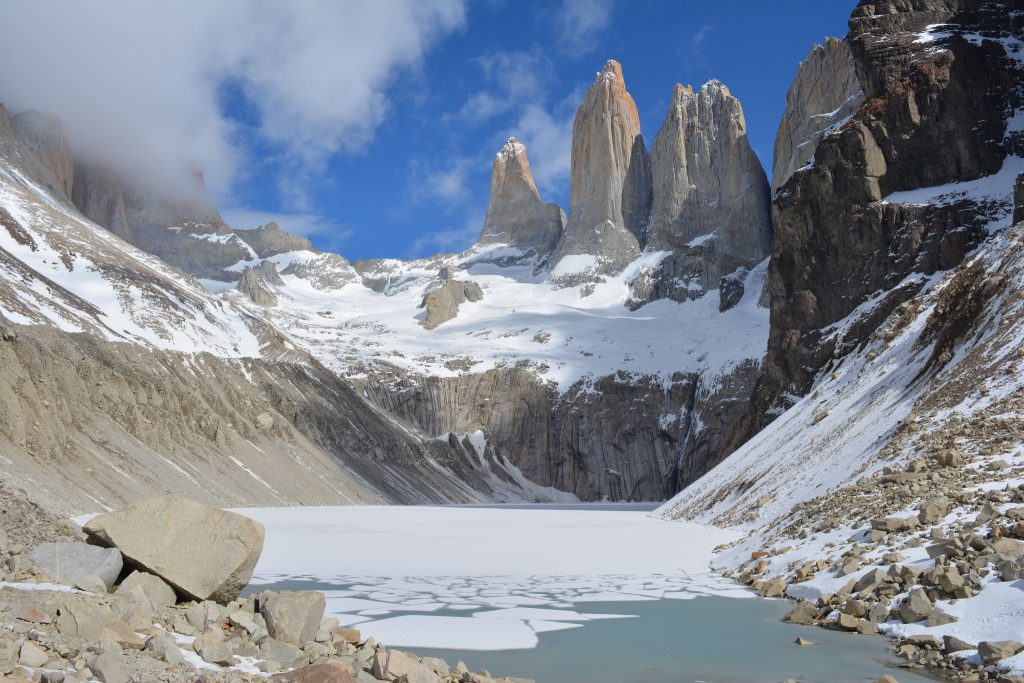 The three Paine Towers.
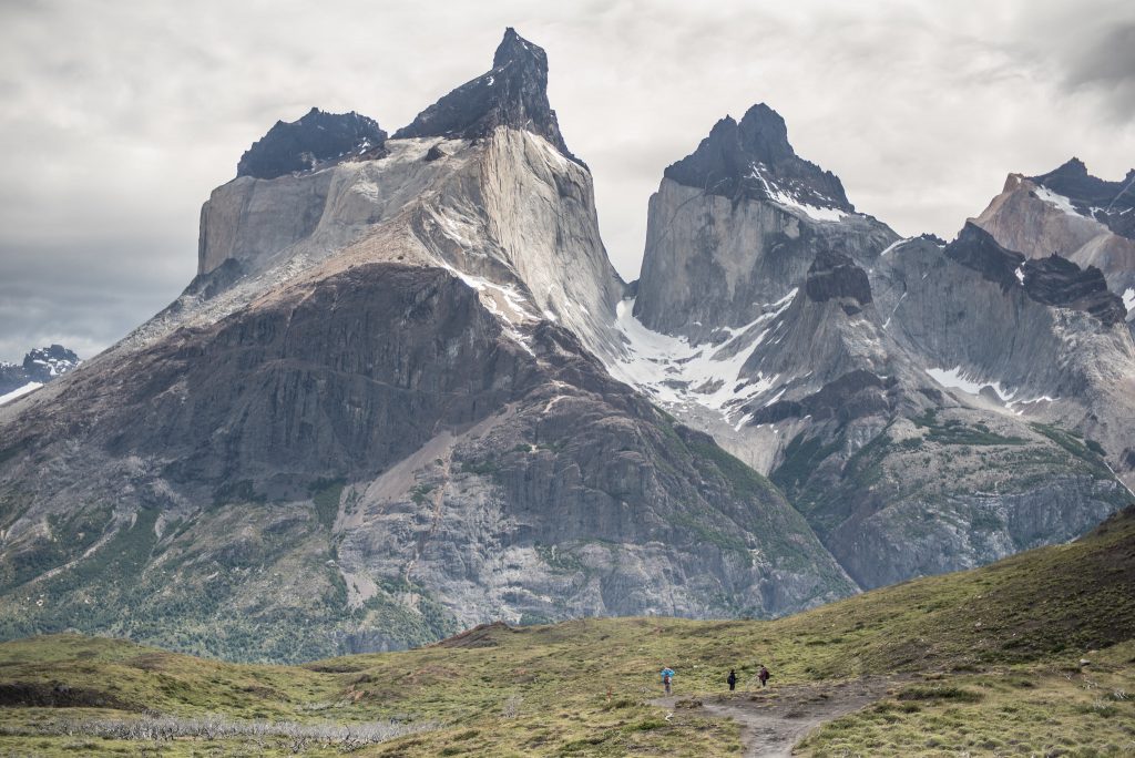 Cuernos del Paine.
Torres del Paine and Patagonia region are full of massive, icy glaciers! The glaciers to see are:
They make up some of the Southern Patagonian Ice Field and its outflow. The Southern Patagonian Ice Field is the second-largest ice field in the world, consisting of more than 12,000 square km. It is part of the former "Patagonian ice sheet," which is still left from the last glacial period.
Chile contains the majority of the Southern Patagonian Ice Field. Approximately 15% of it is in Argentina. Scientists rank this massive ice sheet as the second largest in the world. The other ones are Antarctica and Greenland, spanning 350 kilometers.
Sadly, the area is diminishing year by year. Climate change is pushing this process. Glaciers are melting, and sea levels are rising.
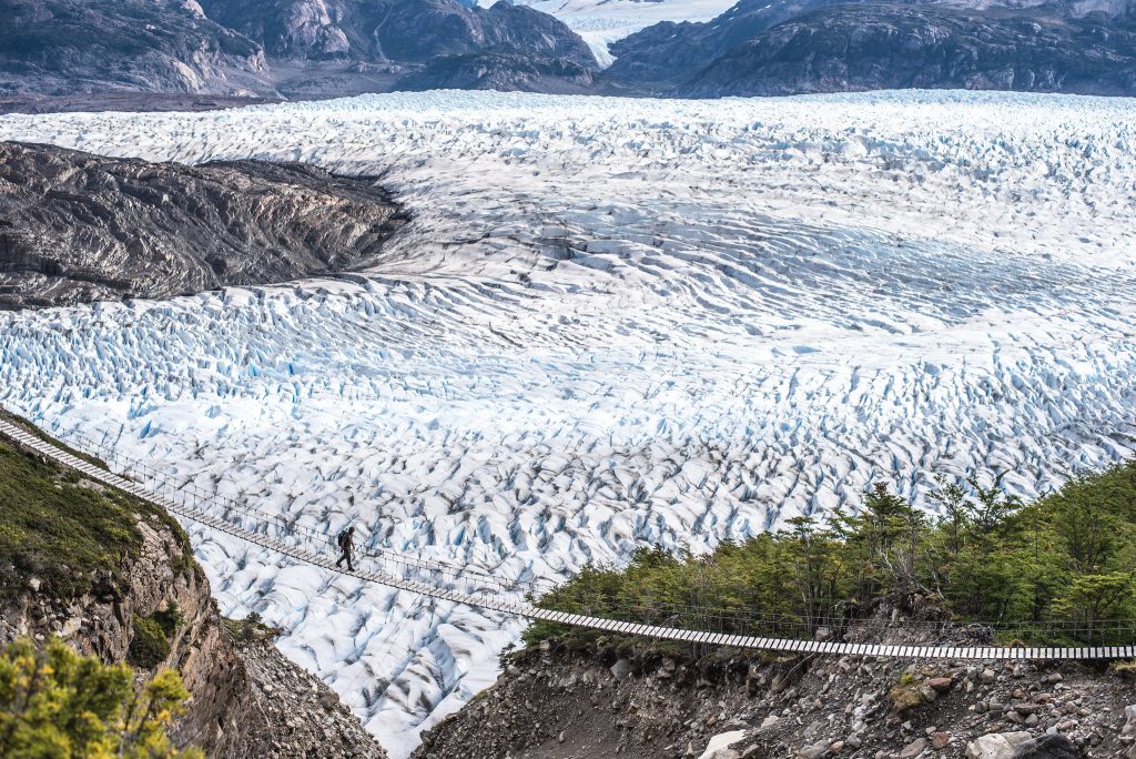 Grey Glacier.
Within Torres del Paine National Park, there are various large lakes making up 90 square km of surface area. Each lake is different, but many have a strong turquoise color to them.
This intense coloring is due to rock flour particles that are left from glacial erosion. They make the water appear milky.
Some of the well known lakes include:
 Nordenskjöld Lake.
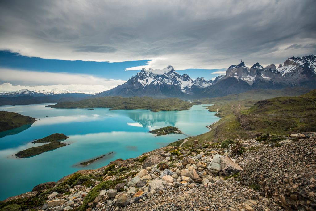 Pehoe Lake.
There are three major waterfalls in Torres del Paine.
The waterfalls are small in comparison to places like Iguazu or Niagara Falls. However, they offer something special to the landscape in Torres del Paine. Many travelers enjoy viewing these waterfalls and admiring all its incredible natural surroundings.
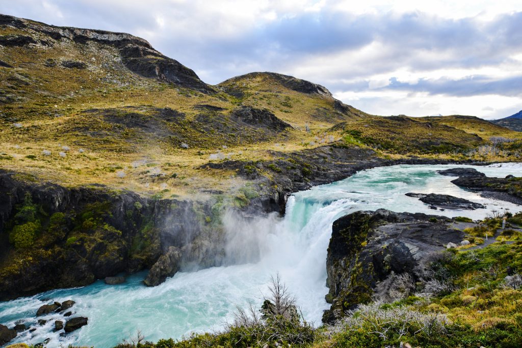 Salto Grande.
Various rivers run through the park, connecting all the magnificent land masses. Four major rivers are worth seeing:
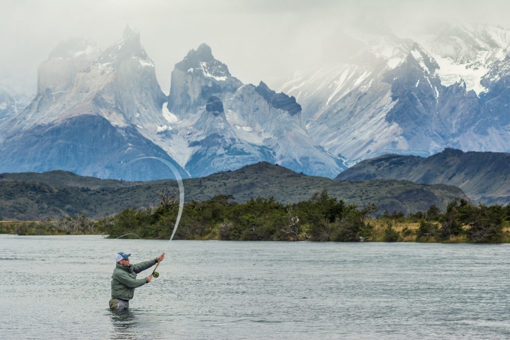 Serrano River.
In 1978, UNESCO acknowledged Torres del Paine National Park as a Biosphere Reserve. This means that it is internationally recognized as an ecosystem. It can be used for scientific research to protect the environment.
This biosphere reserve consists of three parts:
The rugged lanscapes of the area offer diverse ecosystems that makes this place a paradise for wildlife. Torres del Paine has the highest density of pumas in the world. And birdwatchers will find a high level of endemism with plenty of fascinating species.
If you're looking for an epic experience, you can combine mountain biking, hiking, horseback riding and kayaking on an epic multisport adventure!
Do you want more information? Visit cascada.travel and learn about our programs
Insider's guide: When to visit Patagonia

